Space archaeologists need your help to protect ancient treasures
New website enlists the public to pore over satellite images for signs of possible looting
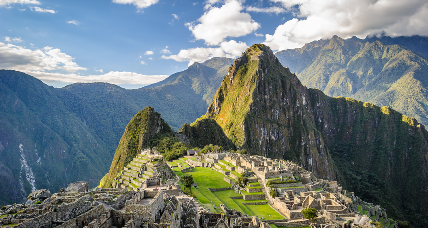
Peru’s most famous ancient site is Machu Picchu, which was founded by the Incas in the 15th century. Archaeologists are reaching out to the public to find other sites — and protect them from looting.
Siempreverde22/iStockphoto
Thieves are stealing ancient artifacts in Peru and the country needs your help to stop them. You can join the adventure without even leaving home. Just put on your best Indiana Jones hat and log on to GlobalXplorer°.
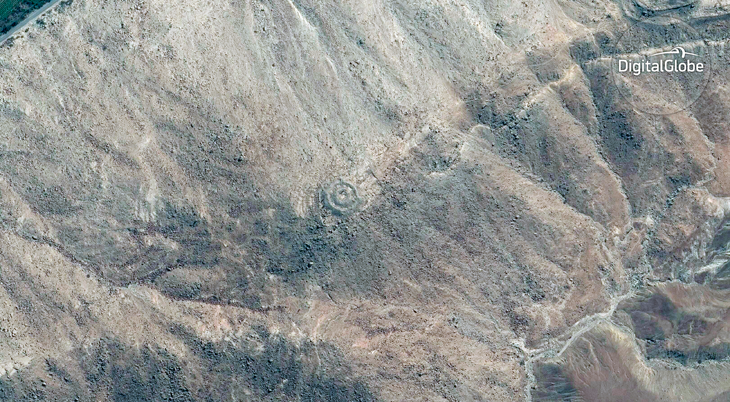
This new website trains people to hunt for ancient ruins in satellite images. Maybe they will find a temple hidden in the jungle. Or pits dug by robbers trying to plunder that temple.
“This is just as much about protecting sites as it is about finding new sites,” says Sarah Parcak. She works at the University of Alabama at Birmingham. As an archaeologist, she studies human history and prehistory. Her work may involve using artifacts and other physical remains to learn about the past. Last year she won a $1 million prize. It’s given each year by the TED organization to support some big idea. Parcak used her money to create GlobalXplorer°. It turns regular people into “space archaeologists.”
Satellites look down on Earth from hundreds of kilometers (miles) above. They cannot see below the ground. But they can reveal clues on the surface that hint at what lies beneath. Space archaeologists use satellite images to scout for sites worth exploring.
Parcak and her team have already found thousands of interesting locations using space imagery. They discovered buried pyramids in Egypt and settlements the Vikings may have built in North America. But the team also has found signs of trouble. Last year, Parcak warned the world about thousands of holes dug in Egypt by looters. Looting is the stealing of valuable objects, and it often occurs during war or other times of social upheaval. Looting has become a big problem in Egypt, especially when people there are having financial problems.
Looting also has become a problem in Peru. There, the government wants to do more to fight this crime. That nation is home to many well-preserved archeological sites. One the most famous is the citadel Machu Picchu. The Incas built it more than 600 years ago.
Looking for allies to help her stop this destruction, Parcak turned to the public. Most people are very good at recognizing objects in pictures. And that can be very useful for science. One project called Galaxy Zoo asked the public to help astronomers find galaxies by poring over images of space taken by a telescope. Some 150,000 people signed up to do this in just the first year. They classified 50 million galaxies, most of which no one had ever seen before. They even discovered some weird and unexpected objects that surprised scientists.
Story continues below image
How good human beings will be at finding archaeological sites in Peru, or elsewhere, is not known. “Satellite pictures are not simple photos,” notes Nicola Masini. An archaeologist, he works for Italy’s National Research Council in Rome. With computers, he analyzes satellite images to explore Peru. Computers can notice things the human eye cannot. For instance, these digital spies can see small differences in how light is reflected off of different things on the ground. And that might signal promising sites to excavate.
So far, more than 29,000 people have signed up with GlobalXplorer°. Volunteers will focus on catching looters in its first campaign, which lasts until March 15 of this year. (After that, new campaigns will ask volunteers to check out other things.)
For the Peru search, the website divides the nation’s surface into a grid of 120 million squares. Each square is about the size of two football fields placed side by side. Visitors to the site look at satellite images of the squares. They click a button if they see something suspicious, such as a dark hole or a bulldozer. Everyone is scored based on what they flag. Those who notice something that is then confirmed by other people get a higher score.
If enough people mark a square, Parcak and her team will flag it. They can then use that information to plan trips to investigate those sites.
No one except for Parcak and her team know the exact location of each square, though. They do not want thieves to use these images to find the next spot for a heist. That, after all, would defeat the whole purpose of the project.


