Coastal cities around the world are sinking, satellite data show
This sinking makes coastlines even more vulnerable to rising seas
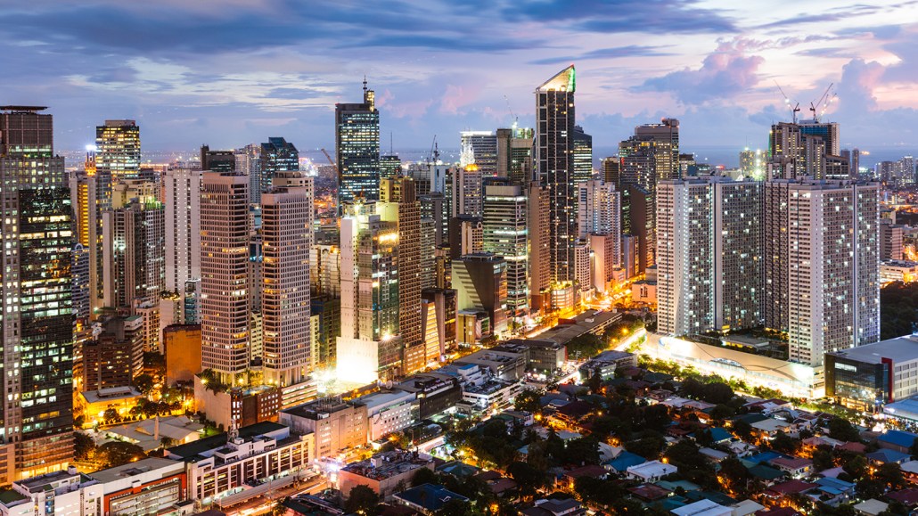
Manila, a city in the Philippines, is among the fastest sinking cities on the planet. Some areas of the city are sinking up to 1.5 centimeters (two inches) per year.
Matteo Colombo/DigitalVision/Getty Images
New satellite data reveal an alarming reality for coastal cities around the globe. Many are sinking up to several centimeters (inches) on average per year. Falling land levels is one contributor. But at the same time, sea levels have been rising due to climate change. That one-two punch puts coastal regions at greater risk for flooding than had been expected.
Researchers shared their new finding in the April 16 Geophysical Research Letters.
Matt Wei is an earth scientist at the University of Rhode Island. That’s in Narragansett. He was part of a team that studied 99 coastal cities spread across six continents. “We tried to balance population and geographic location,” he says. Subsidence, or land sinking, has been measured in cities before. But past research has tended to focus on just one city or region. This study is different. “It’s one of the first to really use data with global coverage,” says Wei.
His team used observations made by a pair of European satellites. Most of the data were collected from 2015 to 2020. The satellites beamed microwave signals toward Earth. Then, the satellites recorded the echoes as those waves bounced back. Wei’s team measured the timing and intensity of the reflected waves. This allowed the researchers to determine the height of the ground in different places. Those height measurements were accurate to about one millimeter (0.04 inch). And because each satellite flew over the same part of the planet every 12 days, the researchers could trace how the ground deformed over time.
Some places — mostly in Asia — were sinking up to five centimeters (two inches) per year. These regions included Tianjin in China, Karachi in Pakistan and Manila in the Philippines. Spots in 34 of the cities were sinking by more than a centimeter (0.4 inch) each year.
That’s a worrying trend, says Darío Solano-Rojas. He’s an earth scientist who was not involved in the research. He works at the National Autonomous University of Mexico in Mexico City. Coastal cities are being hit with a double whammy. First, sea levels are rising due to climate change. Those waters are swallowing coastal cities up. Meanwhile, land beneath those cities is sinking. “Understanding that [secondf] part of the problem is a big deal,” Solano-Rojas says.
The land-sinking is largely caused by people, Wei and his colleagues suspect. They viewed Google Earth images of fast-sinking regions within cities. There, the team saw mostly housing or business areas. That hints the ground is sinking due to people pumping groundwater out for drinking and other uses.
But there’s reason to be hopeful. Consider the city of Jakarta in the East Pacific island nation of Indonesia. In the past, Jakarta was annually sinking by nearly 30 centimeters, on average. That’s nearly a foot per year! Now, sinking has slowed there and in other places. This may be thanks to recent government regulations that limit how much groundwater can be extracted.
Rates of ground level change in four cities
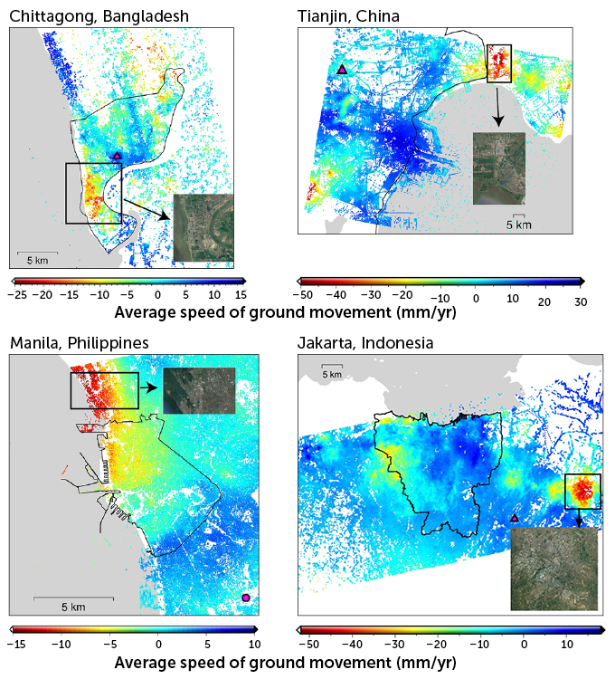
Satellite images taken from 2015 to 2020 track the ground height in dozens of coastal cities. These data reveal how fast many cities are sinking. In parts of some cities — such as these four — the ground is sinking by more than 10 millimeters (0.4 inch) per year.
The color-coding shows redder areas are places where the ground is sinking and (moving away from a satellite). Bluer areas (representing positive values) are places where the ground is rising. Black boxes outline areas sinking fastest. Satellite photos of those areas show that they are home to residential or industrial development. The magenta triangles and circles mark Global Navigation Satellite System stations used in the analysis.


